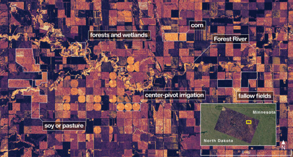
NASA’s first radar images from a new Earth-mapping satellite show the Maine coast and North Dakota farmland in incredible detail. The pictures, released Thursday, are from a spacecraft that rocketed into orbit from India two months ago. The joint U.S.-Indian …
Finance
September 29, 2025
First Radar Images From NASA Satellite Showcase Maine Coast, North Dakota Farmland
Advertisement
Related Articles
FAIA Bans Live Animal Displays After PETA Concerns …
Attendees at the Florida Association of Insurance Agents’ June convention in Orlando may have noticed …
2 days, 15 hours ago
4
Public Adjuster, Already in Prison, Sentenced to Another …
A public adjuster who pleaded guilty in March to defrauding Brotherhood Mutual Insurance Co. and …
2 days, 15 hours ago
4
FAA Extends Significant Flight Cuts at Newark Through …
The Federal Aviation Administration said last Thursday it will extend significant flight cuts at Newark, …
2 days, 15 hours ago
3